Recent Storm Damage Posts
Steps To Take After Storm Damage
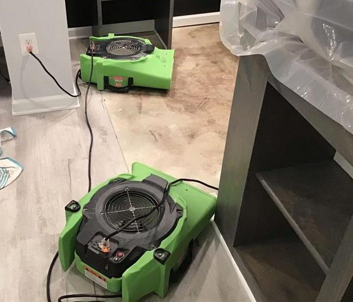
3/25/2024 (Permalink)
A storm can be quite scary and having to deal with its after-effects is challenging. It can leave behind a lot of damage that you will have to take care of. For this reason, you need to have all the right steps in front of you so that you can restore your home as quickly as possible. Here are 5 steps that you will have to follow after suffering from storm weather damage.
Check How Much Damage Is Done
Before you go on to figuring out the solution for the damage, you will have to assess how much damage took place. It is best to take a look at every nook and corner of your home to know where all the damage is.
Don’t miss out on anything as you want to ensure that every bit of damage is repaired properly. Observe every inch of the exterior so that you can know exactly what went wrong. Also, if there is seepage or any other time of damage as well, then make sure to take note of this as well.
Keep Yourself Safe And Avoid Injury
As you go about assessing your home of damage, you want to make sure that you avoid injury throughout. To do this, you will have to keep away from all sorts of electrical equipment and risky areas around your home.
If you see cracks on the roofs, then it is best that you avoid standing under or close to that particular area. The best thing to do is to make sure that your electricity is shut off to avoid getting damage from wires running through your home.
Get Your Insurance Company On Board
Throughout the process, you want to make sure that you are collecting adequate proof to show your insurance company. They will probably also send someone for a physical examination to verify your case. Keep them in the loop so that you can claim insurance for the damages that you face from the storm damage.
Limit Further Damage To Home
Sometimes, if you do not act quickly, there is a possibility of more damage happening to your home. You want to avoid this as much as possible. If there is an excessive wind blowing or water coming in, you might want to board your windows.
If you’re not sure how to do this, then you must reach out to a professional service for help. And, that is our final step that will help with the damage.
Get The Right Professional Cleaning Service
You want to ensure that your home is not damaged beyond repair. This is when you need to get the right people on board to help you clean up the mess after the storm weather damage. You do not want to put the entire work on yourself as you might not have the right equipment to get this done properly.
You should reach out to professionals who can help you clean your home and minimize the damage done to your home. Connect to https://www.SERVPROwoodburydeptford.com/ and get your home cleaned up in no time.
2022 Hurricane Summary
2/21/2023 (Permalink)
2022 Hurricane Summary
According to NOAA; the 2022 season saw three hurricane landfalls along the coast of the U.S. mainland. Hurricane Ian made landfall first as a Category 4 storm in Cayo Costa, Florida, and again as a Category 1 in Georgetown, South Carolina. As a Category 4 with 150 mph maximum sustained winds, Hurricane Ian tied for the fifth-strongest hurricane ever to make landfall in the U.S. Hurricane Nicole made landfall as a Category 1 in north Hutchinson Island, Florida.
Hurricane Fiona made landfall outside of the mainland U.S. as a Category 1 near Punta Tocon, Puerto Rico.
“I commend NOAA’s dedicated scientists, hurricane hunter pilots and forecasters who worked diligently to help American communities become hurricane resilient and Climate-Ready for the impacts of this hurricane season and the years to come,” said Secretary of Commerce Gina Raimondo.
This unique season was defined by a rare mid-season pause in storms that scientists preliminarily believe was caused by increased wind shear and suppressed atmospheric moisture high over the Atlantic Ocean. After a quiet period in August, activity ramped up in September with seven named storms, including the two major hurricanes — Fiona and Ian — seen this season. The season also included a rare late-season storm with Hurricane Nicole making landfall on November 10 along the east coast of Florida.
Sussex County was fortunate again as we did not suffer any close or direct impacts; however we all know that Mother Nature is in charge. If you have any storm damage; please call SERVPRO of Sussex County at 302-856-9768.
Flash Floods - #1 weather-related killer in the US!
9/8/2022 (Permalink)
How do flash floods occur?
Several factors contribute to flash flooding. The two key elements are rainfall intensity and duration. Intensity is the rate of rainfall, and duration is how long the rain lasts. Topography, soil conditions, and ground cover also play an important role.
Flash floods occur within a few minutes or hours of excessive rainfall, a dam or levee failure, or a sudden release of water held by an ice jam. Flash floods can roll boulders, tear out trees, destroy buildings and bridges, and scour out new channels. Rapidly rising water can reach heights of 30 feet or more. Furthermore, flash flood-producing rains can also trigger catastrophic mud slides. You will not always have a warning that these deadly, sudden floods are coming. Most flood deaths are due to FLASH FLOODS.
Most flash flooding is caused by slow-moving thunderstorms, thunderstorms repeatedly moving over the same area, or heavy rains from hurricanes and tropical storms.
Occasionally, floating debris or ice can accumulate at a natural or man-made obstruction and restrict the flow of water. Water held back by the ice jam or debris dam can cause flooding upstream. Subsequent flash flooding can occur downstream if the obstruction should suddenly release.
PLAN AHEAD:
Identify where to go if told to evacuate. Choose several places...a friend's home or a motel in another town, or a shelter.
Know your area's flood risk. For information, call your local National Weather Service office, Red Cross chapter, or local emergency management agency. Check your homeowner's or renter's insurance. Homeowners' policies do not cover flooding. Contact your insurance agent to find out how to get flood insurance.
Even 6 inches of fast-moving flood water can knock you off your feet, and a depth of 2 feet will float your car! NEVER try to walk, swim, or drive through such swift water. If you come upon flood waters, STOP! TURN AROUND AND GO ANOTHER WAY.
Hurricane Thoughts? Keep Your Fingers Crossed…
9/7/2022 (Permalink)
Hurricane Thoughts? Keep Your Fingers Crossed…
With two months of the 2022 Atlantic hurricane season already over with, it might seem like that activity in the tropics has been pretty quiet. Butis it unusual?
By this time in the year, there are typically about four named storms, according to the National Hurricane Center. So far, there have been only three named storms (Alex, Bonnie and Colin), so activity is only slightlybelow average
Meteorologists say there are a variety of reasons why the past two months have been a bit sluggish.
Here’s what’s causing slower activity in the tropics:
1.) The high pressure system normally found over Bermuda this time of year is farther north. This clockwise circulation, near the Azores west of Europe, is dragging dry air down from Europe.
2.) Saharan dust. While there’s less than there was a month ago, the dry and windy air it causes is also inhibiting storm formation.
3.) High winds across the Atlantic basin.
The peak of the season comes around September 10. There’s another reason why this season may seem slower — recent hurricane seasons have been so much more active than average.
Below are the definitions of tropical weather systems:
- Tropical depression: Weaker systems with winds of 38 miles per hour or less
- Tropical storm: Winds reach 39 mph or higher, at which point the storm is officially named
- Hurricane: Winds reach 74 mph or higher. Hurricanes keep the same names they earned when they reached “tropical storm” status
As the leading storm remediation and restoration company in Sussex County; SERVPRO stands ready to assist should this slow pattern take a fast turn toward more severity. Call us with any needs or questions at 302-856-9768.
Hurricane Thoughts? Keep Your Fingers Crossed…
9/7/2022 (Permalink)
Hurricane Thoughts? Keep Your Fingers Crossed…
With two months of the 2022 Atlantic hurricane season already over with, it might seem like that activity in the tropics has been pretty quiet. Butis it unusual?
By this time in the year, there are typically about four named storms, according to the National Hurricane Center. So far, there have been only three named storms (Alex, Bonnie and Colin), so activity is only slightlybelow average
Meteorologists say there are a variety of reasons why the past two months have been a bit sluggish.
Here’s what’s causing slower activity in the tropics:
1.) The high pressure system normally found over Bermuda this time of year is farther north. This clockwise circulation, near the Azores west of Europe, is dragging dry air down from Europe.
2.) Saharan dust. While there’s less than there was a month ago, the dry and windy air it causes is also inhibiting storm formation.
3.) High winds across the Atlantic basin.
The peak of the season comes around September 10. There’s another reason why this season may seem slower — recent hurricane seasons have been so much more active than average.
Below are the definitions of tropical weather systems:
- Tropical depression: Weaker systems with winds of 38 miles per hour or less
- Tropical storm: Winds reach 39 mph or higher, at which point the storm is officially named
- Hurricane: Winds reach 74 mph or higher. Hurricanes keep the same names they earned when they reached “tropical storm” status
As the leading storm remediation and restoration company in Sussex County; SERVPRO stands ready to assist should this slow pattern take a fast turn toward more severity. Call us with any needs or questions at 302-856-9768.
2022 Hurricane Forecast Update
8/12/2022 (Permalink)
Atmospheric and oceanic conditions still favor an above-normal 2022 Atlantic hurricane season, according to NOAA’s annual mid-season update issued today by the Climate Prediction Center, a division of the National Weather Service.
“I urge everyone to remain vigilant as we enter the peak months of hurricane season,” said Secretary of Commerce Gina Raimondo. “The experts at NOAA will continue to provide the science, data and services needed to help communities become hurricane resilient and climate-ready for the remainder of hurricane season and beyond.”
NOAA forecasters have slightly decreased the likelihood of an above-normal Atlantic hurricane season to 60% (lowered from the outlook issued in May, which predicted a 65% chance). The likelihood of near-normal activity has risen to 30% and the chances remain at 10% for a below-normal season.
“We’re just getting into the peak months of August through October for hurricane development, and we anticipate that more storms are on the way,” said NOAA Administrator Rick Spinrad, Ph.D. “NOAA stands ready to deliver timely and accurate forecasts and warnings to help communities prepare in advance of approaching storms.”
NOAA’s update to the 2022 outlook — which covers the entire six-month hurricane season that ends on Nov. 30 — calls for 14-20 named storms (winds of 39 mph or greater), of which 6-10 could become hurricanes (winds of 74 mph or greater). Of those, 3-5 could become major hurricanes (winds of 111 mph or greater). NOAA provides these ranges with a 70% confidence.
So far, the season has seen three named storms and no hurricanes in the Atlantic Basin. An average hurricane season produces 14 named storms, of which seven become hurricanes, including three major hurricanes.
This outlook is for overall seasonal activity, and is not a landfall forecast. Landfalls are largely governed by short-term weather patterns that are currently only predictable within about one week of a storm potentially reaching a coastline.
Please read in case of HURRICANE EVACUATION ORDERS per CDC
8/12/2022 (Permalink)
Be ready to evacuate or stay at home.
Always listen to authorities regarding whether you should evacuate or stay at home.
If a hurricane is coming, you may hear an order from authorities to evacuate (leave your home). Never ignore an order to evacuate. Even sturdy, well-built houses may not hold up against a hurricane. Staying home to protect your property is not worth risking your health and safety.
You may hear an order to stay at home. If driving conditions are dangerous, staying at home might be safer than leaving.
If you need to evacuate:
- Grab your emergency supply kit and only take what you really need with you (cell phone, chargers, medicines, identification like a passport or license, and cash).
- Unplug your appliances. If you have time, turn off the gas, electricity, and water.
- Follow the roads that emergency workers recommend even if there’s traffic. Other routes might be blocked or flooded. Never drive through flooded areas—cars and other vehicles can be swept away or may stall in just 6 inches of moving water.
- Contact your local emergency management office and ask if they offer accommodations for owners and their pets. Learn more about evacuating with your pet.
If you need to stay home:
- Keep your emergency supply kit in a place you can easily access.
- Listen to the radio or TV for updates on the hurricane.
- Stay inside. Even if it looks calm, don’t go outside. Wait until you hear or see an official message that the hurricane is over. Sometimes, weather gets calm in the middle of a storm but then quickly gets bad again.
- Stay away from windows—you could get hurt by pieces of broken glass or flying debris during a storm. Stay in a room with no windows, or go inside a closet.
- Be ready to leave. If emergency authorities order you to leave or if your home is damaged, you may need to go to a shelter or a neighbor’s house.
A Flood of Concerns
8/11/2022 (Permalink)
Kentucky residents who are struggling to rebuild after devastating flooding face huge financial obstacles because almost nobody in the state has flood insurance.
The area hit by the flash floods that began in late July and killed at least 37 people has a large concentration of low-income families.
Only 17,250 property owners in Kentucky have federal flood insurance, government records show. The public program provides the vast majority of flood policies in the United States.
A recent report from Federal Emergency Management Agency found that Kentucky has a low rate of flood coverage and ranks just behind New Mexico in the percentage of residences with flood insurance.
In the 10 counties in eastern Kentucky that sustained significant flood damage in recent weeks, just 2,485 property owners have coverage through FEMA’s National Flood Insurance Program, an E&E News analysis of federal records shows. That’s about 2.3 percent of households in the 10-county area.
Many Kentucky residents decline to buy flood insurance because they think the premiums are too costly and the risk of being flooded is too remote, said Britney Hargrove, a spokesperson for Knott County, which sustained extensive flood damage.
“A lot of families don’t have that extra money to pay for something that may or may not happen,” Hargrove said.
Flood insurance costs an average of about $1,000 a year through FEMA. The median household income in Knott County is $32,500 — half the nationwide median of $65,000.
Flood coverage is sold separately from homeowners’ insurance policies and is considered vital to disaster recovery because policyholders can collect up to $250,000 in claims payments. Federal disaster aid, on the other hand, typically pays residents just a few thousand dollars and covers only temporary home repairs.
The absence of flood insurance and the minimal disaster payments from FEMA are forcing residents to rely on private charity, Hargrove said.
“That is going to be what makes or breaks the county — the foundations and the amount of donations that come in,” Hargrove said.
Another factor discouraging the purchase of flood coverage is that FEMA flood maps have vastly underestimated the flood risk in eastern Kentucky, according to a groundbreaking analysis in 2020 by the nonprofit First Street Foundation.
Nationwide, the foundation found, there are 14.6 million properties that face a significant flood risk — far more than the 8.6 million properties that FEMA says are in flood zones.
The FEMA maps were especially inaccurate in eastern Kentucky, the foundation found.
2022 Hurricane Season Forecast
5/9/2022 (Permalink)
After an active 2021 Atlantic hurricane season, Colorado State University (CSU) predicts that the 2022 Atlantic hurricane season will again be “above-average” with major hurricanes making landfall. The university team projected nine hurricanes, four of which are predicted to be major hurricanes. CSU bases its hurricane season predictions on models that use 40 years of historical data and evaluates conditions, including:
- El Nino
- Sea surface temperatures
- Sea level pressures
- Vertical wind shear levels (change in speed and direction of winds with height in the atmosphere)
- Other factors
The CSU team cites the likely absence of El Niño as the major reason for the “above average” hurricane season. When El Niño is present in the Pacific, its wind shear force can literally break down hurricanes as they form in the Caribbean and Atlantic.
The 2022 hurricane season’s activity will be about 130% of the average season, according to the CSU forecast. Last year’s hurricane season saw about 140% of the average season.
This year’s hurricane season is exhibiting characteristics similar to 1996, 2001, 2008, 2011, 2017 and 2021. All had “above-average” hurricane activity per the Department of Atmospheric Science.
Although Sussex County has not experienced a hurricane since 2022 with Irene causing two deaths in our state. It was almost seventy years between Irene and Hazel – which hit Delaware in 1954. The point is that we rarely see severe hurricanes causing damage in our local area – however the worst thing you can do is lull yourself into a false sense of security…Always be prepared! SERVPRO of Sussex County stands ready to help in the event of any storm – especially the large ones. In fact; our franchise sent a team to New Orleans after Katrina. Any storm that makes landfall in close proximity to our coast will cause at the very least flooding concerns. Be safe!
Common Types of Storm Damage
4/18/2022 (Permalink)
Sussex County, Delaware has been very fortunate over the years to have avoided many major hurricanes and severe weather systems that may wreak havoc on businesses and homes. Seldom do we experience tornadoes or hurricanes; however, history has taught us that they can occur. Recently we have seen an uptick in the number of tornadoes spawned from severe thunderstorms; with two to three reported in the last several years. The most common weather events that we encounter would be Nor-Easters and thunderstorms.
There are many types of damage to inspect for after a storm event. Strong winds can damage your roof and the siding and exterior of your home or business. It is always a good idea to check your roof, shingles, gutters and siding for damage – post-storm.
In the rare case that we should see hail from a local storm; the damage can affect siding, windows, roofing and gutters. Hail is especially harmful to shingle granulation as its contact diminishes this first line of defense on your roof.
Obviously, the most feared damage would most likely be from water damage or fire from a lightning strike. Water intrusion from flooding or storm surge can cause expensive losses to structure and materials. Secondary water damage can come in the form of mold if the water damage is not properly remediated.
Fire damage can cause even more severe damage than water from a large fire and in some cases inflict total loss of property. What is not lost in the fire is typically damaged by soot and smoke as well as water from the extinguishing of the fire.
If you have damage or questions about storm damage – please contact us today at SERVPRO of Sussex County at 302-856-9768 or visit https://www.SERVPROsussexcounty.com for the best restoration and remediation/reconstruction services in the county.
10 Tips to Prepare for Storm Surge
2/14/2022 (Permalink)
According to NOAA; storm surge can be the leading cause of death and damage from severe storms which can affect our local area in Sussex County. Below are 10 tips offered from NOAA to help prepare for a sudden storm surge.
- Storm surge is often the greatest threat to life and property from a hurricane. It poses a significant threat for drowning. A mere six inches of fast-moving flood water can knock over an adult. It takes only two feet of rushing water to carry away most vehicles—including pickups and SUVs.
- Storm surge can cause water levels to rise quickly and flood large areas—sometimes in just minutes, and you could be left with no time to take action if you haven’t already evacuated as instructed.
- Storm surge values do not correspond well to the hurricane wind categories (of the Saffir-Simpson Hurricane Wind Scale) that range from 1 to 5. These categories are based only on winds and do not account for storm surge.
- Tropical storms, category 1 or 2 hurricanes, major (category 3 to 5) hurricanes, and post-tropical cyclones can all cause life-threatening storm surge.
- Storm surge can also occur with non-tropical storms like Nor’easters and other winter storms.
- Many U.S. Gulf and East Coast areas are vulnerable to storm surge, including areas up to several miles inland from the coastline. Find out today, well before a hurricane ever approaches, if you live in a storm surge evacuation zone.
- Storm surge can occur before, during, or after the center of a storm passes through an area. Storm surge can sometimes cut off evacuation routes, so do not delay leaving if an evacuation is ordered for your area.
- During the peak of a storm surge event, it is unlikely that emergency responders will be able to reach you if you are in danger.
- Even if your community is not directly affected by storm surge, it could experience other hazards from the storm and face dangerous conditions such as impassable roads, water and sewage problems, and power outages. If power remains on, downed electrical wires can pose an electrocution risk.
- Weather conditions and the forecast can change. Local officials could issue evacuation or other instructions for many reasons. Always follow the instructions of local officials.
If you have any water or storm damage and require assistance – please call SERVPRO of Sussex County at 302-856-9768.
No tornadoes in our area? THINK AGAIN!
9/8/2021 (Permalink)
The National Weather Service says a trained weather spotter has confirmed a tornado passed through the Hurlock area Wednesday afternoon Sept. 1. Police officers also spotted the tornado. Hurlock is only about ten miles west of Sussex County. Although damage was minor; this is the third such severe weather event in the last three years. The National Weather Service offers these tips as to what to do if and when another tornado hits our area:
Tornado safety preparation tips
- Designate a safe room. This area can either be a storm cellar, a basement or a room on the lowest level of your home or building like a closet. Goto the basement or an inside room without windowson the lowest floor (bathroom, closet, center hallway). If possible, avoid sheltering in a room with windows. For added protection get under something sturdy (a heavy table or workbench). Cover your body with a blanket, sleeping bag or mattress.
- Put essentials in your safe room. ...these include a battery powered radio, a first aid kit water and a flashlight.
- Remove outdoor items. ...outdoor furniture and other yard ornaments become projectiles and can increase damage and risk of injury.
- Reinforce your home. ...with advanced notice – this may be attainable but in most cases there is little time. You can remove dangerous trees so as to lower the risk of falling branches and limbs.
- Contact your insurance agent. If you have incurred damage – report the issues as soon as possible to assure a quick timeframe for appraisal, approval and repair.
If you suffer any type of storm related damage – please call the STORM professionals at SERVPRO of Sussex County at 302-856-9768 and we will offer assistance!
“IDA” Rather NOT!!!
9/7/2021 (Permalink)
Hurricane Ida was a deadly and destructive Category 4 Atlantic Hurricane that became the second-most damaging and intense hurricane to strike the state of Louisiana on record, behind Hurricane Katrina, and is tied for the strongest landfall in the state by maximum winds with Hurricane Laura a year before and the 1856 Long Island Hurricane. As is the case with many storms that make landfall along the coastal areas; the damage continued along its path toward the northeast.
As of September 4, a total of 91 deaths have been confirmed in relation to Ida, including 71 in the United States and 20 in Venezuela. In the United States, 27 deaths were in New Jersey, 18 in New York, 13 in Louisiana, 5 in Pennsylvania, 2 in Mississippi, 2 in Alabama, 1 in Maryland, 1 in Virginia, and 1 in Connecticut. The storm has caused 28 indirect deaths, including 20 deaths from flooding in Venezuela caused by Ida's precursor, and a Louisiana man mauled to death by an alligator after walking through Ida's floodwaters. Two electrical workers died while repairing power grid damage caused by the storm. Four people have died in New Orleans and Jefferson Parrish as a result of carbon monoxide poisoning while using generators with inadequate ventilation. After the storm passed, nearly all of the oil production along the Gulf Coast was shut down. Thousands of crew members were deployed in Louisiana, and hundreds were rescued. Power outages were expected to last weeks, possibly up to a month. States of emergency were declared for Louisiana and portions of the Northeast. Several sporting events were also moved, delayed, or cancelled by the storm.
These numbers illustrate the fact that although our area may not be in the direct path of a hurricane’s landfall or anywhere near it; it can still lead to catastrophic damage and deaths. SERVPRO of Sussex County is the leading storm remediation company in Sussex County and if you suffered any damage from Ida or any storm; please call us at 302-856-9768 and we will be ready to help!
Stormy Outlook
8/13/2021 (Permalink)
While 2021 is expected to be another above-average hurricane season, it is unclear how it will unfold. The National Oceanic and Atmospheric Administration’s (NOAA) Climate Prediction Center (CPC) has updated its definition of the average hurricane season using 1991-2020 instead of 1981-2010. As a result, the “average” season now has 14 named storms and seven hurricanes, three of which will be major (Category 3+) hurricanes. The average number of named storms and the number of hurricanes increased with this change, while the number of major hurricanes remains unchanged. Therefore, the “above average” season prediction will be higher than previous predictions for an above-average season based on the changes of what is considered average.
It has become common practice for predictions for the upcoming hurricane season to be released as early as December 2020, with most organizations releasing their projections between April 8-15. Predictions from five different organizations: The Weather Company, TropicalStormRisk.com, Colorado State University, the University of Arizona and North Carolina State University, are remarkably consistent. All expect 15-18 named storms, 7-9 hurricanes and 2-4 major hurricanes (Category 3 or higher).
“So far, the 2021 hurricane season is exhibiting characteristics similar to 1996, 2001, 2008, 2011 and 2017. ‘All of our analog seasons had above-average Atlantic hurricane activity, with 1996 and 2017 being extremely active seasons,’ said Phil Klotzbach, research scientist in the Department of Atmospheric Science and lead author of the report.” – Colorado State University
For the first time, the National Hurricane Center (NHC) began issuing tropical weather outlooks and forecasts on May 15 instead of June 1 as it recognized that severe tropical weather is forming earlier in the calendar year. And beginning in 2021, once this year’s list of storm names has been exhausted, NHC will use names from a pre-determined supplemental list instead of the Greek alphabet as was past practice.
What is considered storm damage to your roof?
8/13/2021 (Permalink)
Hurricane-force winds, which are classified by meteorologists as 74 mph or greater, or gale-force winds, which are between 39-54 mph, can cause visible damage to your home's roof. High winds can remove or tear shingles, leaving the underlayment, roof deck, or waterproofing material exposed to the elements.
Signs of storm damage to your roof:
- Missing Shingles.
- Visible Granule Loss.
- Visible Water Infiltration.
- Loose Debris.
- Missing or Hail-Damaged Shingles.
- Clogged or Broken Gutters and Downspouts.
- Ice Dams. ...
- Damage to Roof Supports or Accents.
What is classed as storm damage?
Buildings insurance policies usually cover financial loss caused by storm damage. We say that a storm generally involves violent winds, usually accompanied by rain, hail or snow. Any extreme form of bad weather has the potential to cause damage to a property.
What to Do After a Storm Damages Your Roof: 5 Steps to Take
- 1) Be careful and stay alert.
- 2) Assess the damage and take photos of the storm damage.
- 3) Call your insurance agent right away.
- 4) Stop further damage.
- 5) Stay organized and keep receipts.
Does homeowners insurance cover storm damage?
Homeowners insurance may help cover certain causes of storm damage, including wind, hail and lightning. However, damage caused by flood and earthquakes typically is not covered by a standard homeowners insurance policy. Coverage also usually includes damage from hail, wind-driven rain or snow that gets inside the home when a roof or wall is damaged due to wind.
If you have been affected by storm damage – please call our experts at SERVPRO of Sussex County today at 302-856-9768.
10 Tips to Avoid Home Storm Damage
8/12/2021 (Permalink)
- REPLACE MISSING OR DAMAGED SHINGLES - If a shingle is damaged, it’s more likely to break free. If it’s missing, well then you’ve got a gap for wind to get under and do even more damage.
- REPAIR LOOSE SIDING - The same rules as roofing apply to siding: it’s important to ensure your siding isn’t damaged.
- KEEP YOUR GUTTERS CLEAR - Make sure your gutters are free-flowing and your downspouts flow away from your foundation. Water damage or flooding is one of the quickest ways to devalue your home. So ensuring your gutters are clear is the first line of defense in helping water to flow away from your home.
- ENSURE WATER CAN FLOW AWAY FROM YOUR HOME - The grade of your lot should keep water flowing away from your home and into a ditch, drain, or some other proper retention area.
- KEEP YOUR SUMP PUMP IN WORKING ORDER - Before the rainy season starts up, we suggest checking whether your sump pump is in working order. If you want to feel extra-secure, having a backup sump pump is a sure-fire way to prevent basement flooding.
- ENSURE PROPER SEALING OF DOORS AND WINDOWS - Wind only needs a small opening to get underneath something like a shingle or siding and rip it off.
- CHECK FOR LOOSE FENCE POSTS - Wind will surprise you. Anything that’s not nailed down is a liability, and that includes fence posts, which are often forgotten or ignored in homeowner’s storm-prep.
- REGULARLY TRIM YOUR TREES - Problem tree limbs can damage your home, a vehicle, or even your neighbor’s property. Regularly trimming the trees on your property is an excellent way to protect your roof and windows.
- WALK AROUND YOUR PROPERTY - If you know a storm is coming, there are some very basic steps you can take to minimize its impact. Like identifying the items around your property that could become projectiles.That means lawn furniture, tools, flower pots, or other yard debris. Do yourself a favor and move those items to a garage, a shed, or indoors.
- KEEP A GENERATOR ON HAND - A bad storm could potentially knock out power to your home for a couple of hours — or days. Having a generator on standby could go a long way towards ensuring you don’t lose your food, or the livability of your home until power is restored.
Weather Ready or Not? SERVPRO of Sussex County Can Help With Storm and Wind Damage!
5/10/2021 (Permalink)
The U.S. Hurricane season typically runs from June 1 until November 30 each year with more and more storms occurring over recent years. This year appears to be no exception with the Pacific region seeing its first Tropical Storm – Andres almost two weeks earlier than the western severe weather season was to begin on 5/15. That being said; at least 17 named storms are predicted – 5 more than anticipated in past years. Although, the Delmarva region has luckily been spared from most Tropical Storm and Hurricane damage – we remain in the Eastern zone where past destruction has occurred.
Most Tropical Storms including hurricanes bring heavy rain, strong winds and possible tidal surge and flooding. Obviously flooding will typically cause the worst damage and harm – but let’s not ignore the damaging effects of strong winds. Falling trees can be deadly and winds over 25mph can rip the siding and shingles from your home and cause other “minor” damage. In such cases; most people would reach out to a tree removal specialist as they are one of the only groups that will respond and typically only if a tree has been involved or needs to be altered or removed. But what about the structural damage to your home? In many cases it may only be shingles or a piece of siding or displaced gutter – who will assist with these issues? SERVPRO has prided itself and built a great national reputation as a top storm remediation and restoration company. SERVPRO of Sussex County stands ready to not only take your call – but to implement a plan of action to correct the issue and fix the damage.
You may feel that a job may be too small or aren’t certain who can help; this is why you should call the community’s trusted leader in storm clean-up for almost 30 years! If you have any wind or storm damage concerns – please call SERVPRO of Sussex County at 302-856-9768 and we will offer or find the resources you need to make it "Like it never even happened."
“Tis An Ill Wind That Blows No One Any Good…”
4/19/2021 (Permalink)
This is an old proverb that means generally when the wind blows; some good may come of it. The “Ill” wind referred to, means that no good will come to anyone from some winds. An example would be a hurricane which typically packs ill winds that cause destruction. Wind should be everyone’s concern. If you have ever witnessed a tornado or the aftermath; you know that strong wind can not only destroy but it can kill. Unfortunately, recent events have brought this to fruition.
Although we rarely see tornadoes here in Sussex County; we do have several Nor-Easters per year. Let’s also not forget that we can get an occasional hurricane as well. But tornadoes, Nor-Easters and hurricanes are not the only types of winds that cause damage. A few weeks ago we had severe thunderstorms in our area and I suffered some minor damage to the siding on my home. A large piece of fascia had torn loose and was dangling precariously over my garage. It needs to be stated that I suffer from a bad back and when I say bad – I mean that a jellyfish has a stronger spine. So of course; I took to Google and found no one that would assist me because most were tree specialists and a handyman would not waste the thirty minutes to drive to my home for the ten minutes of work. This situation made me think of how many other home owners had the same issues and while driving the local roads I saw other homes with minor damage. What did I do? I did what you should do – I called SERVPRO of Sussex County and the fascia was fixed promptly and properly.
So if you find yourself needing someone to respond to what you and others may feel is a small job – call SERVPRO of Sussex County. We will help you with even minor wind damage and of course our team has all the know-how and equipment to help with the large jobs as well. No job is too small if it is of concern to any of our local patrons. Call us at 302-856-9768 to find out how we can help!
14 Ways Winter Storms Can Damage Your Home
2/15/2021 (Permalink)
- Snow and Ice strain the roof – the excess weight of even a minimal amount of snow can weaken your roof – it is always a good idea to have your roof inspected once a year – especially so if the roof is more than ten years of age
- Ice dams weigh on your gutters – uh…gutters…mine are a mess and I don’t even want to think about how much damage freezing ice can do throughout the winter - *Clean your gutters every year!
- Cold cracks caulk – most people don’t realize that ongoing cold weather causes caulk to pull away from windows and may lead to leaks
- Winter remedies damage your driveway – salt and melt-away products are typically harsh and should be rinsed away as soon as possible – this is also true of your vehicle – GET THE SALT OFF!
- Snow and Ice snap tree limbs – I have written about five blogs on the dangers of trees too close to your home – here is another reason to create a safe perimeter – if too much snow or ice weighs heavy on a tree or limb – look out below!
- Freezing temperatures can affect your plumbing – if the temp is expected to drop below 25 degrees for several days – take precautions to keep your pipes from freezing
- Wet conditions rot doorframes – not just rom snow and ice but from improper drainage issues as well – water can do more damage than you can imagine
- Shoveling chips and cracks steps and driveways – a heavy plastic snow shovel will eliminate chips and damage from shoveling
- Melting snow leaks into the basement – make sure your crawlspace is and the seal on your foundation is in-tact to prevent such an expensive calamity as water intrusion
- Changing temperatures can crack the chimney – have your chimney swept and inspected annually
- Intense weather changes damage your deck – you should properly stain and seal your deck with six months of installation and re-apply every year.
- Cold weather can freeze your sump pump – keep your basement as warm as possible to prevent this issue
- Freezing temps can damage your vinyl siding – check your siding after winter events to make sure a small repair does not become a large one
- Ice and frost can damage your foundation – this is usually prevented with proper drain spout extensions directing water away from your foundation
Please call SERVPRO of Sussex County today for any winter weather concerns – 302-856-9768!
Severe Storm Preparation
9/11/2020 (Permalink)
Severe Weather Preparation
Whenever severe weather is approaching there may not be enough time to properly prepare your family and your property. It is always a good idea to know what to do and when to do it. In most cases locally; severe weather strikes in the form of thunderstorms with the potential for wind, thunder and lightning and heavy rain. There are a few steps that each household should take to prepare for such events.
- Secure your property and keep trees trimmed and remove dead branches and store any outdoor furniture or items safely. Branches, lawn chairs and garbage cans can quickly become projectiles in a severe storm and cause damage to your home, vehicles and property.
- Keeping your gutters and drainpipes clean will help to properly direct the flow of potentially damaging flood waters away from your home and crawlspace.
- Check the condition of your roof. If repairs are needed; apply them before the bad weather strikes.
- Prepare an emergency safety plan for your family and include methods of communication and an escape route to a safe meeting place.
- Keep an eye on the sky and pay attention to local weather information.
- If severe weather threatens; check on the elderly, disabled, the very young and pets and farm animals.
- Keep extra ice on hand to properly save and store your perishables.
NOTE: ACCORDING TO NOAA – IF YOU ARE AWARE OF WHAT WEATHER EVENT IS ABOUT TO IMPACT YOU – YOU ARE MORE LIKELY TO SURVIVE SUCH AN EVENT. NOAA WEATHER RADIO OR THEIR WEBSITE IS THE BEST SOURCE FOR ACCURATE WEATHER INFORMATION.
If severe weather does hit; please always remember that SERVPRO of Sussex County is ready 24/7 to help you to regain control of your life! Please reach us at 302-856-9768 or visit us at http://www.SERVPROsussexcounty.com/.
More Hurricanes?
9/11/2020 (Permalink)
More Hurricanes?
NOAA’s Climate Prediction Center has predicted between 19 and 25 named storms for the 2020 Hurricane season. To date – we have already had 16 named storm with four disturbances churning currently in the Caribbean and South Atlantic. So, does this mean we can expect more storms each year and why? In 2017 – there were 17 named storms and in 2018; we had 15. Last year there were 18. Overall, the number has not fluctuated a great deal; however the school of thought indicates that climate change may produce more catastrophic storms in the future.
The rising of warm, moist air from the ocean helps to power the storms. Two other factors may also be contributing to the rising intensities of hurricanes. First, warm air holds more water vapor than cold air—and the rising air temperatures since the 1970s have caused the atmospheric water vapor content to rise as well – this would reinforce the theory that climate change may cause more storms.
So why is there a “season” for hurricanes? Almost all hurricanes develop once the northern hemisphere approaches summer, with the hurricane season running from 1 June to 30 November. The season peaks between August and October. This is because wind shear, which can disrupt hurricanes, dies down during summer, while the temperature of the oceans rise and the amount of moisture in the atmosphere increases. These conditions are ideal for spawning hurricanes.
No matter the number of storms or their intensity; SERVPRO of Sussex County stands ready to assist with both the severe and minor damage that a hurricane or tropical storm may cause. Be prepared, stay calm and call SERVPRO of Sussex County at 302-856-9768 for any storm related concerns.
Tropical Disturbance
8/18/2020 (Permalink)
Any storm that causes damage or fear can also offer inconveniences. I kept telling myself how fortunate we were to have had no real structural loss. I have to admit that losing your power while the news sources are telling you where the tornadoes were was less than tolerable. It was off for most of the day and I acted quickly – since in the past it was out for 48 hours and we ended up in a hotel. I made my way out bypassing two main roads which were blocked by fallen trees, and managed to get to a small convenience store and bought 30 pounds of ice. This decision saved all of our perishables and I was rather happy that I still had some of those old coolers in my garage. It is always a good idea to keep some extra ice on hand even if your fridge makes it for you. You will need more to store dairy and meat overnight.
Another small inconvenience related to the loss of power was of course – no air conditioning in 90+ degree heat. This issue forced us to a hotel later that evening as there was no sleep to be had in a pool of sweat. I know right now anyone who is reading this is saying – Buy a Generator! We only have had a couple of these serious events annually and the cost simply does not justify the return so we make do.
If you have a pet you must not forget about their needs as well. Since the hotel was not pet friendly – we took our dog Zeik to my son’s for the evening as they had power but only one bedroom.
But through each small irritation I kept reminding myself of the serious damage all around me and the loss of life in other states. SERVPRO of Sussex County will be there for you during the major headaches – hopefully your fortitude and patience will get you through the minor ones. If you have storm damage and need help call us at 302-856-9768 today!
Recommended Long List of Storm Emergency Kit Items
8/18/2020 (Permalink)
With the number of names storms twice the number they were at this time last year – we revisit the importance of preparedness.
- Backpack or storage tub to hold your supplies
- Bottled Water
- 1 gallon per person is recommended
- Non-Perishable food
- If including canned foods, you must include a can opener
- Flashlight with extra batteries
- First Aid Supplies
- Bandages
- Ointment
- Disinfectant wipes
- Tissues
- Toilet paper and bags with ties for personal sanitation
- Paper and pen or pencil(to take notes, play games, etc)
- Sleeping bag or warm blanket(recommend one for each person in your home)
- Wrench or pliers to turn off utilities
- Personal hygiene items (travel size deodorant, cotton swabs, feminine items, etc)
- Whistle to Signal for help
- Important documents (identification, insurance information, banking information, wills, etc)
- Emergency reference materials such as a first aid book
- Battery powered radio and a NOAA Weather radio
- Formula and diapers (if there is an infant in the house)
- Extra pet food (if there are pets in the house)
- Dust mask or cotton t-shirt, to help filter the air
- Plastic sheeting and duct tape to shelter-in-place
- Can opener for food (if kit contains canned food)
- Cups and utensils
- A change of clothes for each person in your home (if you live in a cooler climate make sure the clothes are warm!)
- Also include a jacket, hat, gloves and closed toe shoes for walking (boots or sturdy sneakers are best)
- Rain gear
- Cash
- Paper towels
- Fire Extinguisher
- Cards or game (it is important to have something to do to take your mind off the situation for a few moments or alleviate stress if you will be in your shelter for an extended time)
Call SERVPRO of Sussex County for any storm related damage at 302-856-9768 or visit our site at: https://www.SERVPROsussexcounty.com/
Tropical Storm Isaias to Say – Harder to Forget – Hard
8/17/2020 (Permalink)
On early Tuesday morning, August 11, 2020; Tropical Storm Isaias passed near the Delmarva area. Typically, a tropical system has winds and rain and can be rather fearsome; however this one added something special for all of us locally – TORNADOES!
Almost every Delmarva county was hit by some cyclonic activity – including several verified twisters. One was too close for comfort. It went through eastern Sussex County near Long Neck – Millsboro area and I was in awe by its strength – almost 4 miles away. Power was lost by ten am and trees began to come down just afterwards. My yard was so full of debris that it took over three hours of bending and about twenty full trash cans to restore it to the pre-bomb look. But I was very lucky.
Maybe my vocational tie to SERVPRO makes me more aware – however I drove through sections around my home that had sixty foot oak trees fall on home and I saw one that had to be fifty feet tall miss a home by less than a foot. Every yard looked worse than mine.
The tall oaks around my home are a daily worry as we progress through hurricane season. I once spoke with an arborist and he stressed how important this issue is at the time of planning new construction. The space between the home and any trees can be a crucial factor in the damage and destruction to homes and roofs by high winds. If you have an option – consider the trees type, size and growth potential and create a safe distance.
SERVPRO responded to many calls last Tuesday and we offer a board up service and can even store your valuables if needed. If you have any storm related damage – call us today at 302-856-9768 or visit: https://www.SERVPROsussexcounty.com/.
A Lake in The Basement
2/24/2020 (Permalink)
Storms can bring all kinds of chaos with them. From winds and falling trees, to lightning and fires, there is always a chance the dice will roll for disaster. In Sussex county, one of the most common situations we respond to is groundwater flooding. Heavy rain and improperly sealed basements are usually the culprit. One recent incident stands out. A crack in the foundation allowed rainwater to gradually creep into the furnished downstairs basement. This was not immediately noticed by the homeowner, as they had installed a floating, laminate floor in the home. By the time SERVPRO was called, the flooring was completely ruined. Our team removed the flooring to expose the bare foundation and placed the furniture out of harms way. Due to the surrounding soil and location of the basement, this leak repeated after heavy rains for some time.
SERVPRO met our drying requirements and moved our equipment off the property at the request of the customer. We highly recommend that homeowners take a proactive approach to groundwater issues by contacting SERVPRO at the first sign of potential disaster. We offer free inspections, and can put you in contact with the right people to permanently fix the issue and save your home.
If you have groundwater flooding, don’t hesitate to give SERVPRO a call 302-856-9768.
Be Ready with ERP!
9/10/2019 (Permalink)
More than 50% of businesses close down following a disaster; and many never reopen. This 50% or more suffer from the same symptoms; lack of planning and preparation. They also have failed to learn the lesson learned by every other business who either weathered an emergency or lost some assets or everything. Of the businesses that typically do survive; the majority of them had a preparedness plan in place. Think of the pre=planning as an insurance policy. Just as having auto insurance gives us peace of mind when we drive; an ERP (Emergency Ready Profile) gives a business peace of mind when facing the challenges of nature and everyday life.
An ERP will speak trust to your employees and your customers and instill a sense that your company is ready for whatever happens.
SERVPRO offers an ERP that will minimize downtime and replace business interruption with an immediate plan of action. Knowing what to do, when to do it and who to call is essential in the critical time prior to an emergency. The ERP is a start-up approach that offers critical information needed to begin mitigation and recovery. It provides a quick reference to important building and contact information. SERVPRO applies more than 40 years of experience in dealing with both natural and man- made disasters to each ERP.
The SERVPRO ERP provides the following:
- A no cost assessment of your facility.
- A concise Profile Document that contains only the critical information needed in the event of an emergency. This requires minimal effort to complete and offers maximum time savings in an emergency.
- A guide to help you get back into your building following a disaster.
- It establishes your local SERVPRO Franchise Professional as your disaster mitigation and restoration provider.
- It identifies the line or chain of command for authorizing work to begin.
- It provides facility details such as shut-off valve locations, priority areas and priority contact information.
Call SERVPRO at 302-856-9768 Today and Let’s get your business READY!
Be Prepared for Severe Weather!
9/5/2019 (Permalink)
Severe Weather Tips
When severe weather is approaching there may not be enough time to properly prepare your family and your property. It is always a good idea to know what to do and when to do it. In most cases locally; severe weather strikes in the form of thunderstorms with the potential for wind, thunder and lightning and heavy rain. There are a few steps that each household should take to prepare for such events.
- Secure your property and keep trees trimmed and remove dead branches and store any outdoor furniture or items safely. Branches, lawn chairs and garbage cans can quickly become projectiles in a severe storm and cause damage to your home, vehicles and property.
- Keeping your gutters and drainpipes clean will help to properly direct the flow of potentially damaging flood waters away from your home and crawlspace.
- Check the condition of your roof. If repairs are needed; apply them before the bad weather strikes.
- Prepare an emergency safety plan for your family and include methods of communication and an escape route to a safe meeting place.
- Keep an eye on the sky and pay attention to local weather information.
- If severe weather threatens; check on the elderly, disabled, the very young and pets and farm animals.
NOTE: ACCORDING TO NOAA – IF YOU ARE AWARE OF WHAT WEATHER EVENT IS ABOUT TO IMPACT YOU – YOU ARE MORE LIKELY TO SURVIVE SUCH AN EVENT. NOAA WEATHER RADIO OR THEIR WEBSITE IS THE BEST SOURCE FOR ACCURATE WEATHER INFORMATION.
If severe weather does hit; please always remember that SERVPRO of Sussex County is ready 24/7 to help you to regain control of your life! Please reach us at 302-856-9768 or visit us at http://www.SERVPROsussexcounty.com/.
Hurricane Facts for Delaware
8/30/2019 (Permalink)
As Hurricane Dorian approaches the coast of Florida, residents of Delaware may wonder just how much of a threat any storm may pose to our state. Although tropical storms and hurricanes can bring devastation, death and destruction – historically Delaware is a very fortunate. In fact, if you research as far back as 1785 – there have only been two named storms which actually brought hurricane force winds to the state. Those two storms were Irene in 2011 and Sandy in 2012. Storms in 1878 and 1903 also caused hurricane force winds; however we did not begin naming hurricanes until 1953 when only female names were used. This changed in 1979 again when we began offering both male and female names for hurricanes.
Most catastrophic storms can bring a high death toll as well and we tend to remember the storms that caused the most loss of life. Another interesting fact is that the state o f Delaware has only incurred around only 270 deaths from storms since 1785. During the same period in the state of Florida – there were well over 10,000 deaths! Hurricane Andrew alone killed 65 people in FL.
Perhaps we are fortunate or just plain lucky. With science predicting many more storms each season; it may just be a matter of time until Delaware has major storm damage. One thing is certain – we should learn the lesson on how these storms have affected others and always be prepared and vigilant. It is easy to say” Delaware is rarely in the eye of the storm.” Hope for the best and prepare for the worst.
Don’t Let Your Guard Down…..It’s Still Hurricane Season!
8/19/2019 (Permalink)
Some scientists predict more cyclone activity will occur in both the Atlantic and Pacific due to global climate change. A recent report from NOAA predicts that we should expect at least 12 tropical storms with 6 becoming hurricanes at this half way point in the season. Typically, we see more local storm activity from August through October. Although we have not had any major storm threats this year – we are still located along the central east coast which generally means that we are in an area of risk.
The greatest threats we face from a tropical storm or hurricane are storm surge and flooding from heavy rains. Most of Sussex County is located at or below sea level which means any heavy rain or storm surge can cause damage to coastal properties. If strong winds are present; this can be a threat to the coast and other areas. Strong winds are especially dangerous for manufactured homes.
Torrential rains associated with a hurricane or tropical storm will typically affect homes that are located well inland as well. Although strong winds will generally cause significant damage; the leading cause of deaths has historically come from storm surge and flooding. There are many other bodies of water in Sussex County that compound the issue of storm surge; such as bays, rivers and estuaries. Looking back at previous local storms; we have seen Rt. 1 between Dewey Beach and Bethany Beach become obstructed with flood water and in many cases has become impassable.
SERVPRO of Sussex County stands ready to help in the event of any storm. We have the personnel and resources to restore your property to its original state. We advise that everyone pay close attention to the weather and always heed the warnings as they appear on your smart phone. Stay safe!
If It's Thunder......Expect The Lightning!
8/3/2019 (Permalink)
The forecast warns there will be a chance of thunderstorms, but the weather is balmy and slightly cloudy. As evening draws near, you hear the distant rumbling of thunder and catch a flash of lighting on the horizon. Recently, a powerful lightning storm rattled the Sussex County region. It lasted several hours as it moved over the county. Large storms bring added dangers to homeowners. Strong winds can cause trees and branches to damage your property and home. Lightning itself can pose a significant fire risk should it make contact with your home.
The morning after the storm, SERVPRO of Sussex County received multiple calls from homeowner’s who had become the victims of storm damage. We were quick to send two technicians out to investigate and assist the homeowners in determine the best course of action. Upon arrival, we discovered that two homes had been struck by the same bolt of lightning. It had diverged and started electrical fires in both homes. The local fire department was quick to respond and put out the fire in the late hours of the night. As we performed our inspection, it was clear that there was extensive smoke damage to the interior of one of the homes. This was caused by burning wiring, wood, and other building materials. The remaining fumes and debris posed a serious health risk to the families living there, and we recommended they limit their time in the home until it could be properly restored.
While statistically unlikely to occur, home lightning strikes can cause significant damage to your home. If you live in an area that regularly experiences strong storms, there are a few things you can do help protect your property. One of the most effective ways for homeowners to do this is by installing a home lightning protection system. These are items such as:
? lightning rods
? main conductors
? grounds
? bonds
? surge protectors
For an additional level of protection, unplug your electronics during electrical storms. This will prevent any power surges from affecting them. Lastly, consult with a representative from your homeowners or renter’s insurance company. Make sure that you are covered and know how to handle a claim when the time comes. If you have experienced fire damage and are looking for a trustworthy restoration partner to service your home or business, look no further than SERVPRO of Sussex County!
Please Don't Ignore Tornado Warnings!
4/22/2019 (Permalink)
Last Sunday night my wife and I were watching television and saw weather alerts on our local channels advising the threat of severe weather including possible tornadoes. The warnings are not atypical – however fortunately Delmarva does not experience many tornadoes. I have lived here for more than thirty years and have heard of maybe two or three. Needless to say, my mind was filled with more thoughts about the Game of Thrones episode I had just watched than thoughts of tornadoes.
At about three am we heard our cell phones blast a tornado warning advising that everyone in the area seek shelter. My wife got up and began to poke and prompt me to get out of bed and seek a safer place to shelter. I still did not take it or her seriously and simply rolled over and tried to get back to sleep. My wife gave me hell for being so lackadaisical and we laid in bed and heard the storm. It was very intense; but fortunately we were not in any danger zones and faired with no damage or injury. However, when I got up the next morning and turned on the local television channel I saw that there had indeed been a tornado.
About twenty miles west of our home in Lewes an EF2 tornado touched down near Laurel and tore a path of destruction about 100 yards wide and over ten miles long. It was not until I drove from my office over to Laurel to see the damage first hand that I began to scold myself for my stubbornness and my stupidity. Homes were obliterated, trees uprooted, roofs missing and debris was everywhere. Small and large structures shared the same misfortune and many families lost almost everything. I kept thinking over and over – THIS COULD HAVE HAPPENED TO US! My laziness and ignorance could have placed the life of my wife and our beloved dog in harm’s way. What made my guilt even worse was the thought that there is no excuse – I was given plenty of warning. The fact that there were no deaths or injuries from the storm told me that others had in fact heeded the timely alerts. Fortunately, I may have been the exception and not the rule.
The moral of this story is rather obvious – Pay Attention and Heed Warnings of Danger! If you suffered any storm damage – please call SERVPRO of Sussex County and we will be happy to assist with the clean up.
Tips for Proper Pet Care during a Disaster
9/10/2018 (Permalink)
Tips for Proper Pet Care during a Disaster
Whether it be an extreme Nor’easter or a Category 5 hurricane; we should all have a plan for our families and our own personal safety. Many of us think of our pets as important family members and we should consider their safety as well. We have all seen the heart wrenching images of lost pets from past storm events. If you have any uncertainty about proper protection for your pet during such an event; the Humane Society of the U.S. offers the following tips and guidance for such an event:
- Do not leave your pets behind.
- Apply a securely fastened identification tag to your pets’ collar and carry a current photo of your pet with you. Also include on the tag your name and phone number and the same information for a family member or friend who knows you and your pet. This will help to ensure that whoever finds your pet will be able to reach someone who knows you.
- Transport your pets in secure carriers and keep them on proper leashes and harnesses.
- Contact hotels in the safe location and ask if you may bring your pets. Ask the hotel manager to waive the no-pet policy in accordance with the disaster response and remember that most public shelters do not admit pets. There are certain hotels who allow pets and a little google search may offer this information prior to the emergency.
- Call friends, family members, veterinarians or boarding kennels in the safe zone to arrange foster care for your pets if needed.
- Pack a week’s supply of food, water and other provisions, such as medications and cat litter.
- Do not wait till the last moment to evacuate – most responders will not take your pets during emergency rescues.
- Keep a list of emergency phone numbers. (veterinarian, local animal control, animal shelters and the number for the Red Cross)
SERVPRO of Sussex County shares in the public hope that we all stay free from threats and disasters; but we respect the reality of their occurrence. If you have any post storm questions or issues please call us at 302-856-9768 or visit our website: www.SERVPROsussecounty.com for more information.
What is an Emergency Ready Profile and why every Business should have one?
9/1/2018 (Permalink)
What is an Emergency Ready Profile and why every Business should have one?
Ben Franklin once said “If you fail to plan, you are planning to fail.” Winston Churchill said “Those who fail to learn from the past are doomed to repeat it.” Obviously most of us view both of these historical figures as being wise and charismatic. It is the wisdom that we want to extract from each of these quotes when giving thought to emergency preparedness.
More than 50% of businesses close down following a disaster; and many never reopen. This 50% or more suffer from the same symptoms; lack of planning and preparation. They also have failed to learn the lesson learned by every other business who either weathered an emergency or lost some assets or everything. Of the businesses that typically do survive; the majority of them had a preparedness plan in place. Think of the pre-planning as an insurance policy. Just as having auto insurance gives us peace of mind when we drive; an ERP (Emergency Ready Profile) gives a business peace of mind when facing the challenges of nature and everyday life.
An ERP will speak trust to your employees and your customers and instill a sense that your company is ready for whatever happens.
SERVPRO offers an ERP that will minimize downtime and replace business interruption with an immediate plan of action. Knowing what to do, when to do it and who to call is essential in the critical time prior to an emergency. The ERP is a start-up approach that offers critical information needed to begin mitigation and recovery. It provides a quick reference to important building and contact information. SERVPRO applies more than 40 years of experience in dealing with both natural and man- made disasters to each ERP.
The SERVPRO ERP provides the following:
- A no cost assessment of your facility.
- A concise Profile Document that contains only the critical information needed in the event of an emergency. This requires minimal effort to complete and offers maximum time savings in an emergency.
- A guide to help you get back into your building following a disaster.
- It establishes your local SERVPRO Franchise Professional as your disaster mitigation and restoration provider.
- It identifies the line or chain of command for authorizing work to begin.
- It provides facility details such as shut-off valve locations, priority areas and priority contact information.
Call SERVPRO at 302-856-9768 Today and Let’s get your business READY!
Stormy Misconceptions
8/30/2018 (Permalink)
Stormy Misconceptions
The National Weather Service keeps record of the most severe storms to affect the state and the coast of Delaware. As a young boy growing up in this area, I remember people referring to the Storm of ’62 as the worst on record. They told stories of destruction that impacted almost the entire state and especially the coastal communities. Most would assume that such a storm would have been classified as a hurricane and more than likely had made impact between June and November. It was in fact a Nor’easter that occurred in March between the 5th and the 7th and became known as the” Ash Wednesday Storm 1962”. It was also referred to as the “Five High Storm” because it lingered off the coast for five high tides – but most of the damage occurred on Wednesday March 7, 1962 – Ash Wednesday.
Merging low pressure systems and a strong surface high stalled the storm in the Mid-Atlantic and pounded the coast of Delaware for almost three days. The storm also occurred during the equinox. This created even higher tides along with continuous rain and strong winds. Wind gusts reached more than 70 mph and the storm surge was 3 to 5 feet above normal. Wave heights of more than 40 feet were measured off Rehoboth Beach and ranged between 20 and 30 feet in the surf zone. The entire boardwalk and many beachfront homes were destroyed.
Bethany Beach was hit hard with wind gusts exceeding 80 mph and flood waters penetrated as far inland as Ocean View. The boardwalk and many businesses and homes were also destroyed.
Beach erosion forced so much sand inland that many homes had their first floors filled with it and sand covered and closed many roads as well. The erosion also created another inlet; just north of Fenwick Island. Bayside to ocean side; virtually every coastal town had historical storm damage and 8 people were killed. It is estimated that the storm did more than $500 million dollars in damage based on our current dollar value. It is amazing that there weren’t more lives lost.
A storm of this magnitude had not hit Delaware since 1878. Nearly one hundred years had passed since the last killer storm. The infrequency of such events makes them more dangerous because most people doubt the likelihood of such a storm ever taking place in their lifetime.
We are fortunate to have advanced technology to forewarn the public well in advance of such an event. Yet with each new storm we read about people who ignored warnings and paid with their lives. Assumptions that hurricanes are the most severe of storms are not always correct. Delaware has experienced many more Nor’easters than hurricanes and we should learn to heed the warnings and plan for such events.
SERVPRO of Sussex County is ready to serve our community in the likelihood of any storm event – large or small. We offer Emergency Readiness Programs to ensure a safe and proper plan of action and we will be there to assist with the clean-up. For more information – please call us today at 302-856-9768 or visit our website at: www.SERVPROsussexcounty.com
Severe Weather Tips
8/7/2018 (Permalink)
Severe Weather Tips
We hope you are enjoying your summer and thankfully the weather has been fairly good for most of our summertime fun! As most of us realize; however, our weather can change from dreamy to dreary very quickly. We are now in the heart of hurricane season and everyone should hope for the best but be prepared for the worst.
When severe weather is approaching there may not be enough time to properly prepare your family and your property. It is always a good idea to know what to do and when to do it. In most cases locally; severe weather strikes in the form of thunderstorms with the potential for wind, thunder and lightning and heavy rain. There are a few steps that each household should take to prepare for such events.
- Secure your property and keep trees trimmed and remove dead branches and store any outdoor furniture or items safely. Branches, lawn chairs and garbage cans can quickly become projectiles in a severe storm and cause damage to your home, vehicles and property.
- Keeping your gutters and drainpipes clean will help to properly direct the flow of potentially damaging flood waters away from your home and crawlspace.
- Check the condition of your roof. If repairs are needed; apply them before the bad weather strikes.
- Prepare an emergency safety plan for your family and include methods of communication and an escape route to a safe meeting place.
- Keep an eye on the sky and pay attention to local weather information.
- If severe weather threatens; check on the elderly, disabled, the very young and pets and farm animals.
NOTE: ACCORDING TO NOAA – IF YOU ARE AWARE OF WHAT WEATHER EVENT IS ABOUT TO IMPACT YOU – YOU ARE MORE LIKELY TO SURVIVE SUCH AN EVENT. NOAA WEATHER RADIO OR THEIR WEBSITE IS THE BEST SOURCE FOR ACCURATE WEATHER INFORMATION.
If severe weather does hit; please always remember that SERVPRO of Sussex County is ready 24/7 to help you to regain control of your life! Please reach us at 302-856-9768 or visit us at http://www.SERVPROsussexcounty.com/.
 24/7 Emergency Service